Editor’s note: This story is part of “Washout: Our vanishing beaches,” a series about the reshaping of Rhode Island’s shoreline. This interview has been edited for length and clarity.
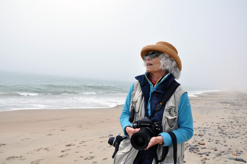
Photographer Kathie Florsheim has held several residencies and fellowships, and her work is permanently held at the Fogg Museum at Harvard, the RISD Art museum and other museums and private collections. As part of an ongoing series on beach erosion by The Public’s Radio, Florsheim invited South County Bureau Reporter Alex Nunes to meet up at her longtime muse: Roy Carpenter’s Beach in South Kingstown.
When photographer Kathie Florsheim walks around the private beachside community at Roy Carpenter’s Beach she’s a familiar face. She doesn’t have a beach place, but she’s been coming here since before the teenagers wandering the narrow dirt roads between tiny beach cottages were born.
She wears a photographer’s vest, sunglasses and straw hat, carrying a Nikon over one shoulder to use as a lightmeter and a large format Pentax film camera to take photos. Kathie began photographing beaches in the 1970s. Early on she was interested in documenting the unique ways we behave when we’re at places like Narragansett Town Beach. Overtime, she saw the coast eroding more and more, and decided to turn her lens to documenting that.
We make our way down the main road into Roy Carpenter’s to where it terminates at the beach. Kathie describes what she’s seeing.
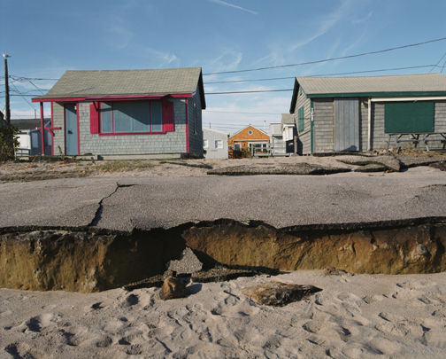
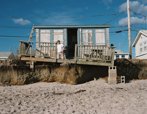
Kathie Florsheim: It’s shocking. I’m dumbfounded. I can’t believe what I’m looking at. See the cottage right at the end – that cottage was built after one of the storms, and I saw where the rocks the size of your fist were deposited by the tide. I couldn’t believe that anybody would put a cottage there, because it was in the same area where the surge had brought a lot of debris. And now it’s right on the beach – didn’t used to be. It’s the kind of thing that gives me double breath. I don’t know what to say.
Alex Nunes: And there previously were other rows of homes in front of us where we are now, where we now see ocean?
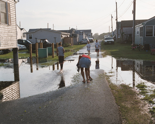
Florsheim: To the left of us there were two rows of cottages, which the land is now open and has dune grass on it. The homes were damaged in Superstorm Sandy. Three of them were completely destroyed and the land under them went with the tide. And the rest of those two rows were pretty badly damaged. The erosion has just really eaten this area.
Nunes: What year did you start photographing at Roy Carpenter’s Beach?
Florsheim: 2004 was the first time I saw it. A friend of mine who is a Rhode Islander knew I was photographing along the coastline and asked me if I’d ever heard of Roy Carpenter’s Beach, and I hadn’t. So I came down here. In 2005, there were two post-tropical storms that really damaged the roadway, which would have been in front of where this group of homes used to be, and the media was covering it. And that’s when I knew I had to come back. The roadway was completely smashed. And I started photographing here very seriously and being here more than I was anywhere else, and following it storm by storm, and got to know a lot of the residents and have been here ever since.
Nunes: What attracts you to photographing an area that’s being eroded?
Florsheim: Because it’s a bellwether. It’s what’s happening to the coastline. I mean, one of the reasons I photograph coastline is because I love it. And if I can make you love it, you won’t let it disappear. You’ll fight, I hope. That’s really the bottom line for me. I want my – if I have an audience – my viewers to get angry, and stand up, and make noise and force the politicians to get off their backsides and enforce some common sense science.
Nunes: Have you come to any conclusions in terms of what you think should happen to areas like this long term?
Florsheim: Yeah, abandon them. Buy out, if we can, those who own shorefront property. Get us out of here before we have to clean up the mess, which will take us out of here eventually.
Nunes: When we come in here, people stop and say hi to you and talk. So you’re obviously a known person here. What do they make of you – someone here documenting the area being washed away, essentially?
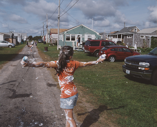
Florsheim: It’s a very tender edge that I’m on. I’m also photographing the joy that these people experience being here. They’re having a really good time. There are neighborhoods here, and there are parties and pop up barbecues. And I’ve been to a number of them. And, yes, I’m documenting what’s going on here. But I’m also interested in how life is lived here. How do you live knowing that you’re probably not going to be here forever? You know, it’s very hard to say please go away, we shouldn’t be on the shore. There are so many families here that have been part of this place since forever. And they can tell you how many generations. I think, eventually, if the erosion continues at this rate, most of our shoreline is going to be shorn of everything on it, and it will be public again. I don’t know what lifetime that is. But I don’t see, with what’s going on and the lack of attention paid to climate change and erosion, that there is any other outcome.
Nunes: Do you think someday people will look at your photos as an elegy to this place or to the shore?
Florsheim: Yes. I’m doing it to chronicle this place, but it may be part of an historical story that 50 years from now – hopefully the photographs still exist somewhere – to say here’s what it used to be like.
Click here to read more from “Washout: Our vanishing beaches,” a series about the reshaping of Rhode Island’s shoreline.
Click here to view more of Kathie Florsheim’s photography.